


 Download
  Application Description
City routes, live traffic, transit routes, parking, offline maps, and navigation are all integral features of the updated 2GIS app. Our latest version has undergone a significant transformation, featuring a fresh design, enhanced search capabilities, improved city updates, and a seamless integration of favorites with 2gis.ru.
Services, Addresses, and Companies
2GIS is your go-to source for detailed information about services and companies. Whether you need to find out which utility provider services your home, locate the nearest district hospital, or identify a post office, 2GIS has you covered. The app not only helps you choose cafes or service centers based on reviews and photos but also provides essential details such as opening hours and contact numbers.
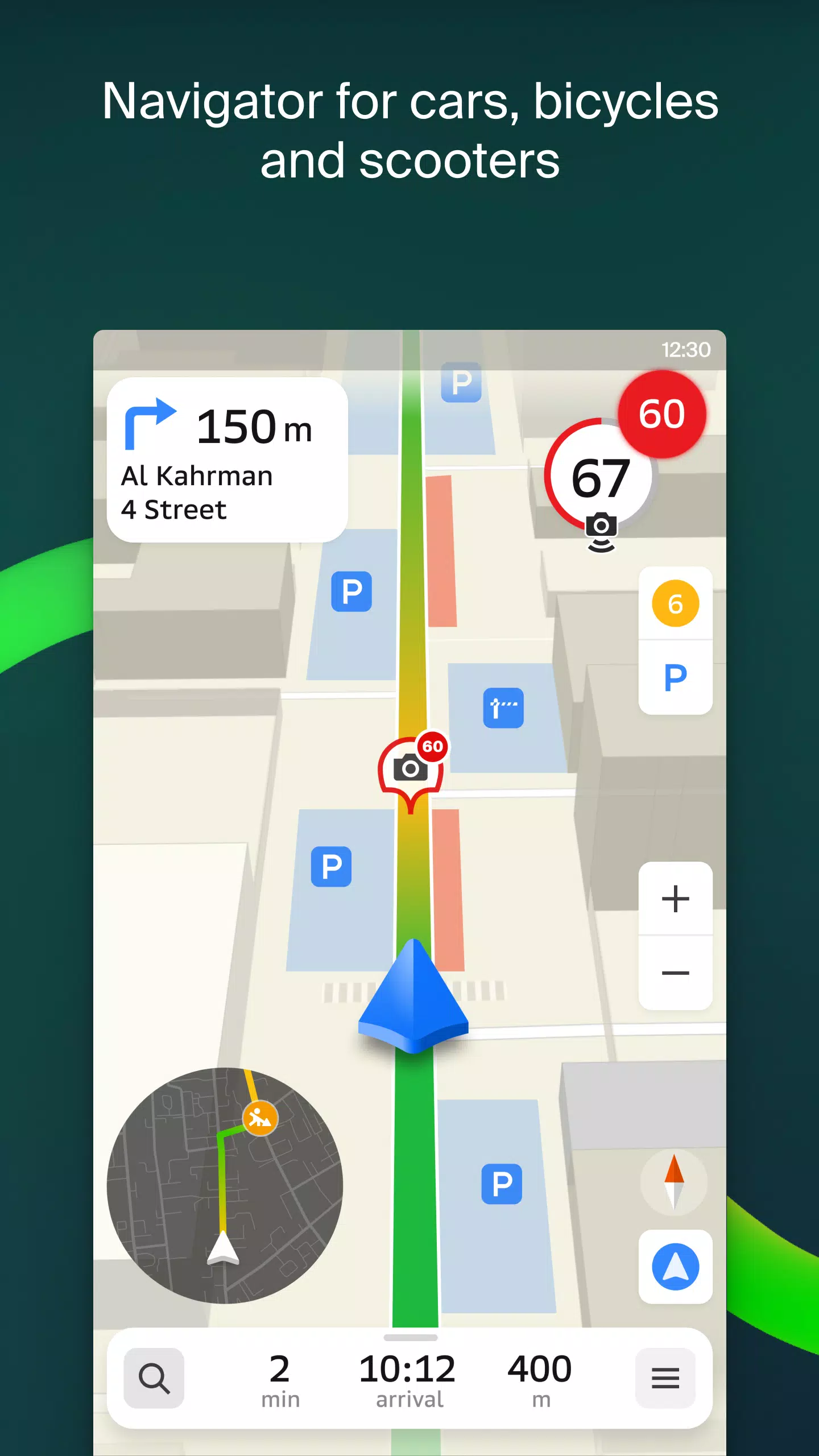
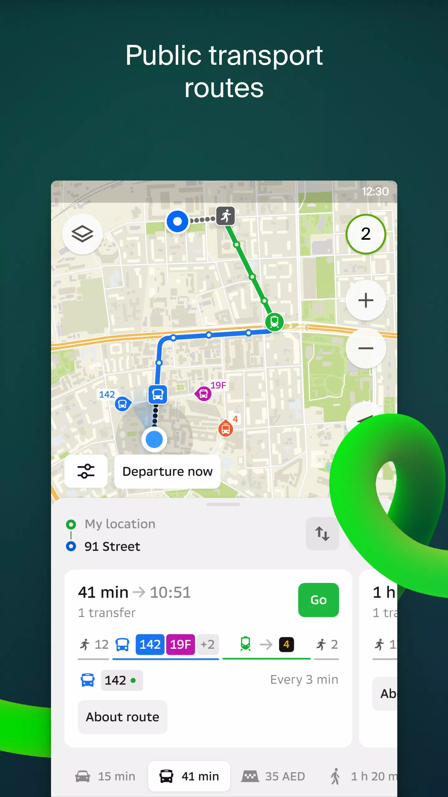
Transport and Navigation
For drivers, 2GIS offers reliable navigation with voice instructions that guide you through maneuvers, taking into account traffic conditions and road closures. If you stray from your planned route, the app quickly recalculates to get you back on track. For those on foot, 2GIS provides options for traveling by bus, metro, train, cable car, or river tram, ensuring you reach your destination efficiently.
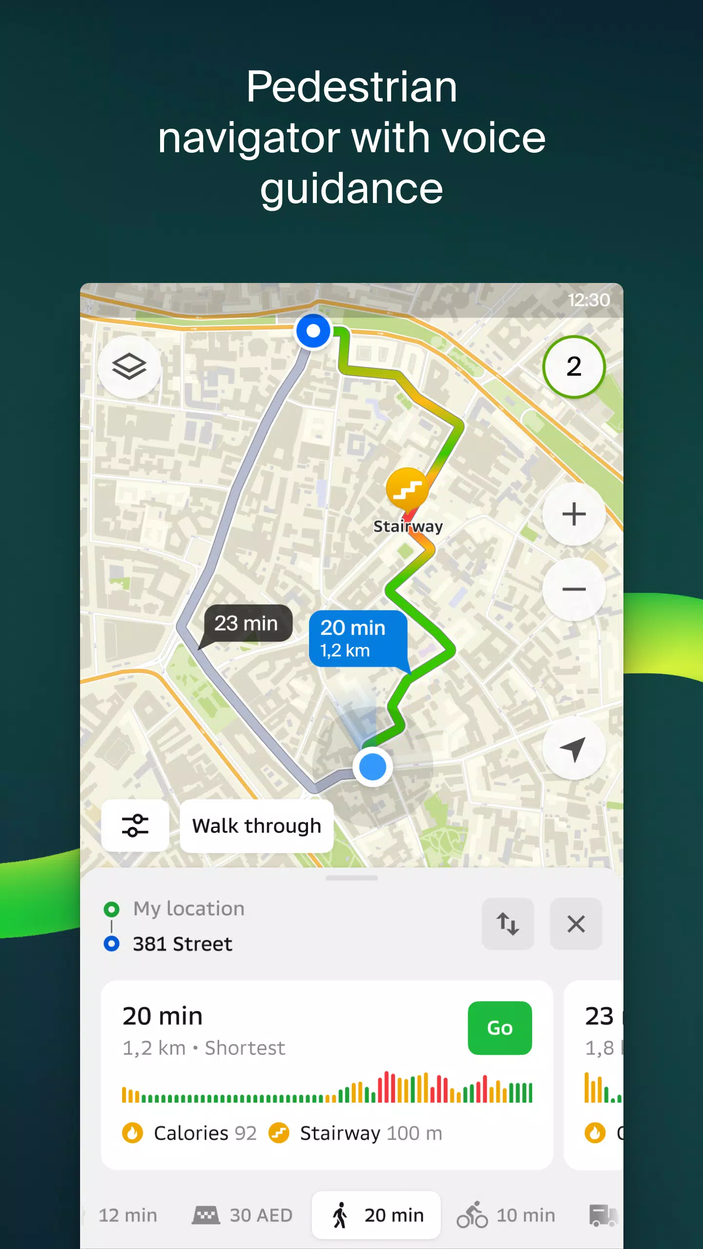
Walking Routes
Pedestrian navigation in 2GIS ensures you can walk to your destination with ease. It functions in the background and includes voice guidance to help you navigate without constantly checking your phone.
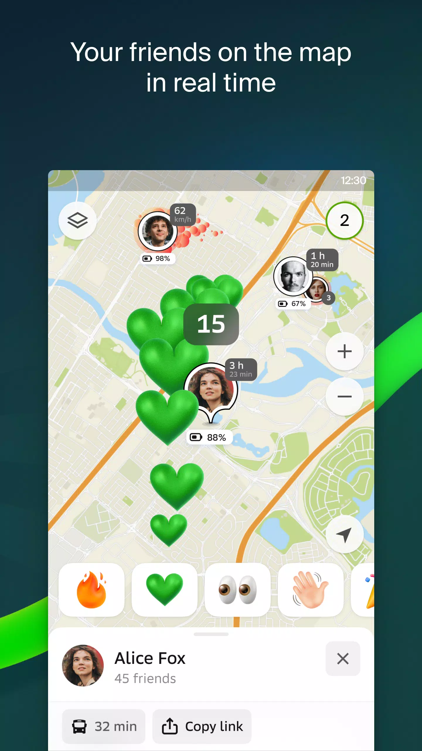
Friends on the Map
Stay connected with your loved ones through 2GIS's real-time location feature. You can add friends and manage who sees your location, giving you control over your privacy.
Building Entrances
Finding the entrance to a business center is no longer a challenge with 2GIS. The app provides detailed information on how to enter over 2.5 million companies and offers precise directions to their doors, whether you're traveling by public transport or car.
Plans of Shopping Centers
Navigating large shopping centers is made simple with 2GIS. The app displays comprehensive maps of shopping centers, including shops, cafes, ATMs, and restrooms, helping you plan your visit in advance to save time.
2GIS Beta Notifications Companion App for Wear OS
Enhance your navigation experience with the 2GIS beta Notifications companion app for smartwatches on Wear OS. This handy tool allows you to view maps, receive maneuver hints, and get vibration alerts as you approach turns or bus stops. It automatically starts when you initiate navigation on your phone and is compatible with Wear OS 3.0 or later versions.
As a beta user, you'll receive the latest updates as bugs and errors are fixed, contributing to the development of the new 2GIS version that millions will eventually use. You can keep the original version installed and switch between the two at any time.
For support, reach out to us at [email protected].
What's New in the Latest Version 6.44.1.559.3
Last updated on Oct 19, 2024
We're excited to bring you these beautiful, crisp updates:
- We now display wide, realistic roads on the main map and when searching for routes.
- Introducing Chats for Friends! Now you can message each other directly within the map interface.
- Added notifications when a friend is nearby, which can be turned off in the settings.
- Just in time for ski season, we've included ski lift statuses on slopes to help you plan your day.
- If your public transport route includes walking, we’ll now calculate the walking part in steps for a more precise journey.
Screenshot
 Reviews
Post Comments+
Latest Apps
MORE+
Reviews
Post Comments+
Latest Apps
MORE+
-
 Speak & Translate All Language
Communication 丨 78.20M
 Download
-
 Rakuten Viber Messenger
Communication 丨 99.20M
Download
-
 Clip TV for Android TV
Video Players & Editors 丨 21.10M
Download
-
 Lounge Prosperity Tiger
Productivity 丨 8.50M
Download
-
 CreationTV
Video Players & Editors 丨 12.90M
Download
-
 EBCNews
News & Magazines 丨 12.03M
Download
Similar recommendations
MORE+
Top News
MORE+

-

-
 Shovel Knight Digs In, Promises More
Jun 25,2024
-

-
 Elden Ring Fan Shows Off Mohg Cosplay
Jan 22,2022
Topics
MORE+
- Your Guide to the Best News & Magazine Subscriptions
- Top Free Puzzle Games on Google Play
- Top Sports News and Score Apps
- Stylized Realistic Art Style Games for Android
- Fun Word Games to Play with Friends
- Top Action Games of 2024
- Must-Have Business Productivity Apps
- Relaxing Casual Games to Unwind With
Trending apps
MORE+
-
1

m.a.i.n59.72M
Introducing m.a.i.n, the revolutionary app that is changing the way we connect and share information. With m.a.i.n, you no longer need to carry around physical business cards or worry about sharing your contact details with strangers. Simply create a m.a.i.n Name and all your contact information and
-
2

Photos Recovery-Restore Images15.00M
PhotoRecovery: Restore Pics is a user-friendly Android app for effortlessly recovering deleted photos from internal and external storage without rooting. Its intuitive interface and robust features scan for and restore major image formats, letting you preview and selectively recover photos. An int
-
3

Yeahub-live video chat79.00M
YeaHub: Your Gateway to Seamless Video ChatStay connected with friends and loved ones, anytime, anywhere with YeaHub, the ultimate live video chat app. Experience crystal-clear video calls that bridge the distance, making communication more than just words. With YeaHub, you can engage in face-to-fac
-
4

Advanced Download Manager56.13M
Advanced Download Manager: Your Ultimate Download CompanionAdvanced Download Manager is the ultimate solution for anyone facing unreliable or slow internet connections. This powerful app acts as your indispensable download companion, ensuring seamless and uninterrupted downloads. Whether you're inte
-
5

YUMS57.16M
YUMS is the ultimate app designed to revolutionize your university experience. It combines convenience, organization, and timeliness to streamline every aspect of your academic life. Forget about the hassle of keeping track of class schedules and attendance manually. With YUMS, you can easily access
-
6

Blued TW151.19 MB
Requirements (Latest version)Android 6.0 or higher is required.
3.3 MB
Download194.2 MB
Download62.2 MB
Download108.1 MB
Download55.7 MB
Download5.4 MB
Download